


BackCountry Navigator GPS PRO
3.42.37K Reviews
App Specs
- Version
- 8.0.5
- Updated On
- License
- $14.99
- Downloads
- 100,000+
- Developer
- Nii Game INC
- Categories
- Maps & Navigation
- Platform
- Android, iOS
Screenshots
 Analysis by AppCompare
If you enjoy getting beyond familiar streets, a navigation app has to do more than show a blue dot: it needs to remain useful when signal disappears and when a route changes. BackCountry Navigator GPS PRO is built around that outdoor problem. My lasting impression is that it can become a dependable planning and orientation tool, but it rewards a little preparation rather than treating every outing as something you can improvise from the trailhead.
Why the first outing feels promising
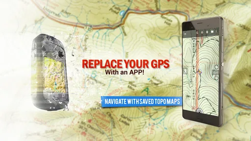
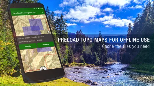
The first appeal is easy to understand. Instead of relying on a live connection, you can prepare map coverage before leaving home and use it outdoors. That changes the phone’s role: it becomes a reference for terrain and position, not simply a screen waiting for mobile data. For a hiker heading into a patchy-signal area, that offline-first approach is more meaningful than a long feature list.
The app suits people who like to know what lies around a route, not just how to get from one point to another. Topographic detail can help you read the shape of the land and think through a detour, while marking a waypoint gives a practical way to save a junction, a meeting point, or a place worth returning to. Those uses are small, but they make the map more personal than a generic turn-by-turn screen.
A realistic outing and a useful routine
Imagine planning a day hike where the trail crosses a wooded section with unreliable reception. Before setting out, I would choose the map area I need, make sure it is available offline, and save any route or reference points I expect to use. At the trailhead, I could check my position against the map; later, if a junction looks unclear, the terrain and saved points offer context even if the phone cannot load online information. The important habit is doing the preparation before the signal vanishes.
Tracking and breadcrumbs are especially useful as a quiet safety net rather than a promise that nothing can go wrong. A recorded line can help me retrace where I came from if I take the wrong turn, but it does not replace a paper map, sound judgement, or telling someone where I plan to go. I would treat the track as one layer of preparation, not as a reason to head out without a backup.
There is also a useful distinction between planning a route and following one. A planned path gives an outing structure, while a breadcrumb record shows the path actually taken. Keeping those ideas separate helps when a trail is blocked or conditions call for a change: I can use the map to assess the situation instead of assuming that a line on the screen must be followed at all costs.
Where it sits among navigation options
Compared with the usual phone maps, this app is more at home with outdoor terrain and offline preparation than with everyday driving directions or finding a nearby business. A conventional road-navigation app is generally the more natural choice for a commute, live traffic, or door-to-door city travel. For a backcountry walk, the ability to keep a prepared map on hand and inspect terrain is the more relevant advantage.
Worth Reading Before You Choose

EA SPORTS FC Mobile 26 Is a Bigger Football Game, but It Takes Time

Flipboard Shows What News Apps Must Do Beyond the Feed

Switching to Android Auto Means Rethinking Your Driving Routine

Google Calendar Makes a Crowded Week Easier to Manage

Ludo King Makes the Most of the Minutes Between Plans

Baby Panda World Brings Quick Play to Modern Phones, but Its Game Library Feels Busy
It also asks more of the user than a simple map viewer. Choosing an area, understanding the map, and planning how to use waypoints or tracks take attention. That effort is worthwhile for people who want control over an outing, but it can feel like unnecessary setup for someone who only wants a quick walking route. I would not pick it as my only navigation app if most of my travel were urban.
One practical workflow is to use a larger screen at home to think through a route when possible, then use the phone outdoors for position checks and navigation. Another is to save a few meaningful waypoints instead of cluttering the map with every passing detail. A short list of useful references is easier to interpret when you are tired or trying to make a decision at a junction.
Living with BackCountry Navigator GPS PRO over time
I find that the lasting value of BackCountry Navigator GPS PRO depends less on how often I open it at home than on whether I build a simple pre-trip routine around it. I’d use a familiar, low-risk outing to learn how map coverage and saved route details work before relying on them farther afield. That habit also makes it easier to judge whether the app’s setup feels worthwhile month after month.
Month-to-month value comes from repeat use
The app’s value is not just the novelty of seeing a moving position on a map. It grows when outdoor trips become regular and the same planning habits are useful again: prepare map coverage, decide what points matter, and keep a track when retracing might help. If I hike occasionally in familiar places, those tools may sit unused for long stretches. If I explore different trails or return to remote areas, offline maps and route handling have a clearer reason to stay installed.
Its audience is therefore fairly specific. Hikers, backpackers, and people exploring beyond reliable service are the natural fit, especially if they are comfortable checking a map rather than expecting the phone to make every decision. Someone who prefers a simple interface with automatic turn-by-turn guidance may be happier with a more conventional navigation app. Likewise, a person who rarely goes outdoors may not get enough recurring use to justify choosing a specialist tool.
Preparation is the maintenance burden
Offline navigation shifts some work from the trail to the time before it. I would check that the intended map coverage is ready, confirm that a route or imported track is the one I mean to use, and make sure saved points are understandable. Those checks are not complicated, but skipping them can turn an otherwise useful app into a last-minute puzzle. This is a planning tool, not magic that downloads the countryside after reception has gone.
Map choice also deserves a little thought. Different map sources can emphasize different details, so the best view depends on what I need to interpret. I would compare the available coverage for the specific area before a trip rather than assuming that one map style will answer every question. A contour-focused view can be useful for terrain; a more familiar street or trail depiction may be easier to scan in another situation.
Imported GPX files add flexibility, but they also create a small responsibility: check that the file corresponds to the intended route and understand that a recorded track is guidance, not proof that a path is open or safe. I would avoid treating a downloaded line as unquestionable ground truth. A route can be old, confusing, or unsuitable for the conditions, so using it alongside the map and local judgement is the sensible approach.
Where fatigue can set in
The same depth that makes the app useful can make it feel less effortless than mainstream navigation. There is preparation to remember, map detail to interpret, and a phone to manage outdoors. Screen use can also be awkward in bright conditions or when I would rather keep moving than stop to inspect a route. For a short, familiar walk, opening a simpler map may be quicker; this app earns its place when its outdoor-specific tools solve a real problem.
Battery planning is another part of the routine. GPS use and looking at a screen are demands on a phone, so I would start a longer outing with a charged device and carry a power bank when appropriate. Even if an app behaves efficiently in one trip, battery life depends on the phone and how it is used. I would not build a safety plan around the assumption that the screen can stay on all day.
BackCountry Navigator GPS PRO is an app in the Maps & Navigation category from Nii Game INC. It has an average rating of 3.5 from around 7,000 ratings, with roughly 2,400 written reviews and over 100,000 installs. That picture suggests a specialist product with a real audience, but not one that will feel ideal to everyone. I would weigh its outdoor focus against my own willingness to prepare and learn its workflow rather than treating popularity as a guarantee of fit.
Cost, compatibility, and who should skip it
The app costs $14.99, with in-app purchases ranging from $3.99 to $24.99 per item. I would consider the initial cost in relation to how often I actually go beyond dependable coverage and whether the available map options suit my destinations. Occasional casual walkers may be better served by an option they already use, while frequent hikers may find a dedicated offline workflow more valuable. Before paying, I would check the current map choices and purchase details in the app store so I know what fits my own plans.
It is rated Everyone, runs on Android 5.0 or later, and its current version is 8.0.5. The app first appeared on June 23, 2010, and its long presence in the category makes it feel like an established specialist rather than a novelty. Still, age alone does not guarantee that every screen or workflow will suit a new user; I would give myself time to learn the controls on a low-stakes walk instead of making a remote trip the first test.
Final thoughts
If you've ever found yourself yearning for the great outdoors, but worried about losing your way, then BackCountry Navigator GPS PRO might just be your new best friend. As someone who's tried a fair share of navigation apps, I was curious to see if this one lived up to the hype. Spoiler alert: it does.
First things first, downloading and setting up the app is a breeze. Available on both Android and iOS, BackCountry Navigator GPS PRO promises to turn your smartphone into a powerful GPS device. Once installed, you'll be greeted by a simple, user-friendly interface that even the most tech-challenged among us can navigate without breaking a sweat.
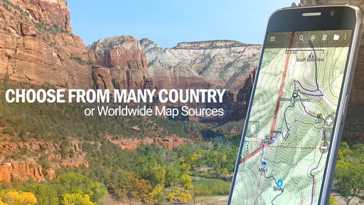
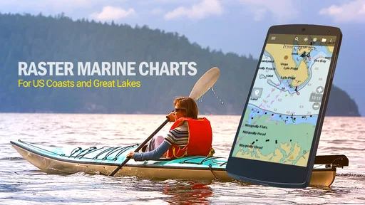
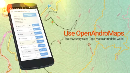
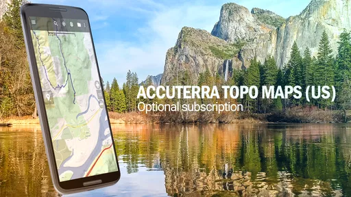
The app offers a variety of maps, from USGS topographic maps to OpenStreetMaps. You can choose according to your preference or the specific needs of your adventure. What I found particularly useful is the ability to download maps for offline use. This feature is a lifesaver when you're venturing into areas with spotty cell service.
Features That Make It Stand Out
So, what makes this app different from the countless navigation apps out there? For starters, the detail in the maps is impressive. Whether you're hiking, backpacking, or exploring off-the-beaten-path trails, you can rely on its accuracy.
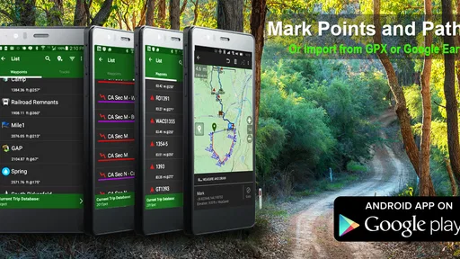
The app also includes features like waypoint marking, route planning, and tracking. You can set waypoints at any location you desire, making it easy to plan your journey or mark spots you want to revisit. The breadcrumb trail feature is another highlight. It records your path as you move, allowing you to backtrack if necessary.
For the tech enthusiasts, there's even support for importing GPX files. This means you can share your routes with friends or download tracks from other users. It's a feature that adds a layer of community and connectivity to your outdoor escapades.
Putting It to the Test
Armed with the app, I set out on a weekend hiking trip. The app performed admirably, guiding me through dense forests and rocky trails with ease. The offline map function was particularly handy, as I ventured into areas without cell service.
One thing that stood out was the clarity of the maps. Unlike some apps that give you a vague sense of direction, BackCountry Navigator GPS PRO offers detailed terrain information, making it easier to avoid potential hazards or find alternate routes.
Battery usage was surprisingly efficient. While using GPS can often drain your phone quickly, I found that the app managed power consumption well. Just remember to bring a portable charger for those extra-long adventures!
The Community Aspect
Another aspect I appreciated was the app's community features. There's a growing online community where users share tips, routes, and experiences. It's a great way to discover new trails and get advice from seasoned explorers.
"One of the best experiences was connecting with other users who shared their favorite hiking spots."
This interaction adds a social element to your solo adventures, making it feel like you're part of a larger network of outdoor enthusiasts.
My long-term recommendation is conditional but clear: I would keep it installed if I regularly hike, backpack, or explore places where mobile coverage is uncertain, and I would build the map-checking routine before relying on it. If I mostly need road directions, quick city walks, or an app that handles every decision automatically, I would choose a mainstream alternative instead. For the right outdoor habit, the preparation is the price of a tool that remains useful after the first impressive trip.
Pros
- Highly accurate offline maps.
- User-friendly interface for navigation.
- Customizable map layers and markers.
- Extensive trail and terrain data.
- Reliable GPS tracking in remote areas.
Cons
- Steep learning curve for beginners.
- Consumes significant battery power.
- Occasional slow map loading.
- Limited support for some regions.
- Premium features require a purchase.
FAQs for BackCountry Navigator GPS PRO
What is BackCountry Navigator GPS PRO used for?
BackCountry Navigator GPS PRO is a top-tier GPS navigation app designed for outdoor enthusiasts. It provides detailed topographical maps that are essential for activities such as hiking, backpacking, and off-road exploration. Users can download maps for offline use, ensuring navigation capabilities even in remote areas without cellular service.
Do I need an internet connection to use BackCountry Navigator GPS PRO?
No, an internet connection is not necessary for navigation once maps are downloaded. You can download maps ahead of your outdoor adventures and use them offline. This feature is particularly useful in areas where cellular coverage is unreliable or nonexistent, ensuring continuous access to navigation tools.
Is BackCountry Navigator GPS PRO compatible with both Android and iOS devices?
Currently, BackCountry Navigator GPS PRO is available for Android devices. The app provides a comprehensive set of features tailored for Android users, but iOS users may need to look for alternative apps with similar functionalities or check for any future updates regarding iOS compatibility.
What types of maps are available in BackCountry Navigator GPS PRO?
BackCountry Navigator GPS PRO offers a variety of map types, including topographical, satellite, and terrain maps. These maps can be downloaded for offline access, allowing users to choose the best map type for their specific needs, such as detailed topography for hiking or satellite images for better visual reference.
How user-friendly is BackCountry Navigator GPS PRO for beginners?
While BackCountry Navigator GPS PRO is packed with advanced features, it maintains a user-friendly interface. Beginners can easily navigate through the app, thanks to its intuitive design. However, some users might need to spend time familiarizing themselves with advanced settings to fully utilize all the app’s capabilities.


